By Michael E. Gouge
It always seems to be there, a quiet, steadfast and eternal part of the landscape. On nearly every motorcycle ride, the French Broad River or its tributaries flow beside me for a while. I see it on my daily commute, during a cruise along my favorite backroad and even while tackling a section of remote mountain twisties. I watch it from the corner of my helmet for as long as can while resisting the bike’s urge to go where I’m gazing. I often catch myself grinning when I round a bend and spot it and notice with a tinge of concern when the water level sinks to its late-summer low or swells to flood stage during the spring rains. Soon the French Broad disappears around a hillside and we part ways – for now.

Life flows on like a river and next to one as well. For most of my life, I lived only few miles from it. Work, play, joy and anguish all unfold as the French Broad slowly passes. An epiphany hit me one day to ride my motorcycle the entire length of the French Broad, at least as close as I could get, from a trickling mountain stream to the mighty Tennessee River. It would be a perfect daytrip through some of the best scenery in the region as it makes it way in a counter-clockwise crescent through the Blue Ridge Mountains west of the Eastern Continental Divide.

I head north from Rosman on N.C. 215, a delight to ride on a motorcycle, and watch the North Fork French Broad River grow smaller and smaller as we climb toward the Blue Ridge Parkway. At the headwaters, a stream emerges at a rustic trout farm a few miles below Devil’s Courthouse to join other modest creeks to become the North Fork, combining with the West Fork a few miles south at the intersection with U.S. 64. A gravel driveway allows me to ride next to the stream as it exits the trout pens. Here it begins a 218-mile journey, tumbling 2,375 in elevation, to join the Holston River to become the Tennessee River outside Knoxville.
The river’s name derives from a colonial-era treaty granting the French control of all rivers flowing west. The English controlled the easterly ones. Since there were two “broad” rivers in Western North Carolina, the “French” designation survived while the English simply shortened the name of their river to the Broad River. During the 19th and 20th centuries, the river became a dumping ground for industrial and agricultural waste.

“People say it’s one of the oldest rivers in the world,” says French Broad Riverkeeper Hartwell Carson. Indeed, some geologists say the French Broad is the fifth-oldest in the world, even older than the Atlantic Ocean. Carson’s conservation organization, Mountain True, works to protect and preserve the waterways and forests of Western North Carolina, which weren’t always so pristine.
“The quote I like to use is, ‘The river was too thick to drink and too thin to plow.’ That’s from Wilma Dykeman’s book,” Dykeman’s 1955 book on the French Broad highlighted the unique mountain culture surrounding the river basin, as well as the growing problem of pollution. “I like to credit the Clean Water Act for really turning things around.”
Today, visitors to the region enjoy rafting along the lazy river, and civic leaders work to revitalize the riverfront. Mountain True also operates the French Broad River Paddle Trail, a great resource to find river access points and overnight camping spots. “I’ve heard from fishermen that it’s one of the better small mouth bass fisheries. For rafters, it has friendly floating sections and up to Class IV whitewater rapids,” he said. “It still has its challenges, but it’s become a great recreational resource. We sometimes wonder now if it’s become too crowded.”
After wandering around Transylvania and Henderson counties near U.S. 64, the French Broad enters Buncombe County near the Asheville Regional Airport. A park along the county line offers rafters a spot to put into the river and float past the new Sierra Nevada Brewery. Farther downstream, Highway 191 nestles up against the river as it runs along the east side of Asheville. During the rainy season, the river nearly touches the roadway and almost seems like a fellow traveling companion. The memorable opening sequence of the cult-classic Robert Mitchum movie “Thunder Road,” where the bootlegger rolls a 1950 Ford, takes place along this stretch near the Blue Ridge Parkway. Across the river, hidden just out of view over the rolling hills sits majestically the 250-room chateau, modeled after those in France’s Loire Valley, built by railroad scion George W. Vanderbilt in 1895. Motorcycle tourers wishing to linger in the Asheville area will find the four-star Inn on Biltmore Estate a perfect place for luxury accommodations and fine dining at the estate’s restaurants, taverns and bistros.
The French Broad arcs around the eastern and northern edges of the 8,000-acre Biltmore Estate. The estate originally included much of the headwaters of the French Broad River. After Vanderbilt’s death, his wife sold 125,000 acres of the land to the federal government to form the Pisgah National Forest. In 1984, archeologists documented the remnants of an ancient Indian village and low mound on the estate near the confluence of the Swannanoa and French Broad rivers where indigenous people lived more than 10,000 years ago. The Cherokee name for the site translates to “the place where they race.” On the northern shore of the river, people still race along the French Broad River, aboard kayaks, on bicycles or in running shoes.
The exhaust burbles as I bank into the parking lot of Amboy Road River Park along this historic portion of the river. Buncombe County and the city of Asheville maintain several scenic river parks along the French Broad, each one perfect to a place to stop the bike and relax for a minute. The river flows quietly along, offering a pleasant setting for enjoying a snack from my Suzuki’s tail bag. From Biltmore, I press northward along the eastern shore of the river through Asheville’s River Arts District. Studios, galleries, and a new major brewery cluster in this revitalized area. The famous 12 Bones Smokehouse restaurant attracts a line of hungry carnivores waiting to enjoy their delicious ribs. What once housed tobacco warehouses and automobile junkyards today hosts a collection of eclectic open-air bars, rafting companies and bike lanes.
Traffic eases as I make the turn onto Highway 251 at the Woodfin town limits heading for Marshall. For the next 20 miles, I’ll get to enjoy riding within view of my river, sharing the same bends and squeezing between the same hillsides. For the first time since I started following the headwaters, I begin to see a lot more fellow motorcyclists and spend much of this run waving to other riders and moving over for my two-wheeled cousins, the bicyclists. The river enters the small county seat of Madison County in Marshall. Down the street from the picturesque old courthouse hangs a dealership sign for American Motors, a relic from the long-defunct automaker still in place since the closing of the car lot. Leaving Marshall, the French Broad runs parallel, but on the other side of the ridge, from U.S. 25. I lose sight of the waterway for the next several miles.
Rolling into Hot Springs, I cross the bridge over my river again. Everywhere in the small mountain resort town, the streets seem lined with motorcycles: gleaming cruisers, heavily modified supersports, large touring bikes. I spot a line of adventure bikes and back my Suzuki V-Strom 1000 into the lineup. Time for lunch. I walk into the Iron Horse Station and spot about a dozen fellow riders clad in boots and textile riding gear. They’ve trekked all day up from South Carolina to enjoy riding the mountains around the French Broad’s watershed. The group, mostly riding BMWs, fill a long table in the restaurant and tavern next to the railroad crossing. Laughter and smiles abound as they recount the day’s adventures.
“We’re up here all the time,” said Lee Zeis of Greer, South Carolina. “We come for the twisty roads — the tighter, the better.” The Beemer crew usually stops at Iron Horse Station before making their way back down the Blue Ridge. “We come here often when we’re up here.”
They got an early start and by midday in Hot Springs, the group had covered some impressive territory on their sport-touring and adventure motorcycles. “We were on Big Laurel and a couple of back roads. We ran into a bit of gravel on the roads, but we’ve got the bikes for it,” said Chris Parker just before the efficient staff at the Iron Horse Station arrived with his lunch. “We’re heading down 209 on the way home.”
N.C. 209, known to riders as “The Rattler,” twists its way south from Hot Springs down to Interstate 40 and eventually Lake Junaluska. It features everything from sharp, cliffside curves to gentle sweepers and even a long, relaxing straight-away across a wide valley. Part of me wants to join them, but the river flows westward and so must I. Banking right on U.S. 25, I climb the hill above the town past the large stone monument marking this as part of the Robert E. Lee Dixie Highway, a pre-Interstate route from Miami to Chicago. I spot the river, now to the east of me, as it heads toward Paint Rock, an ancient Indian pictogram on a cliff near the N.C./Tennessee state line. Again, the highway engineers pull me away from the river’s path.
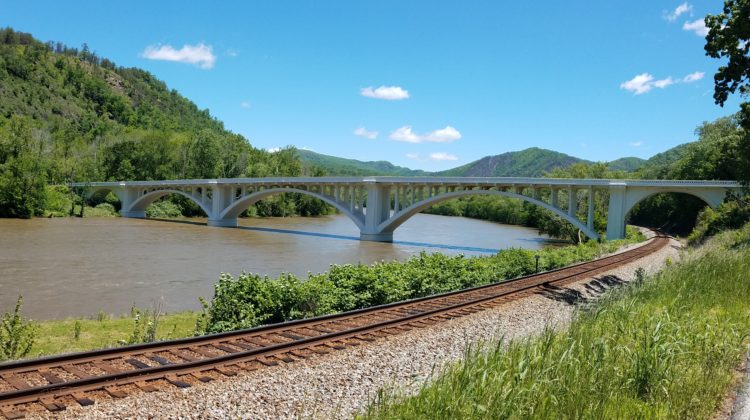
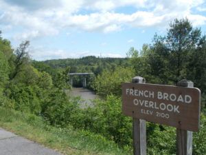
A few miles inside the Volunteer State, Highway 25 suddenly makes a 90-degree turn to cross the French Broad on the stunning 1928 Wolf Creek Bridge. This gleaming white open-spandrel-arched bridge, restored in 2014, carries travelers to the northern shore with a backdrop of green mountains. Side roads on each end allow motorcyclists to stop to enjoy the bridge’s architectural details, and signs proclaim the French Broad a designated scenic river. Downstream a few miles in Del Rio, Bobarosa Saloon draws crowds of bikers for cold beer, fast food and live music. The biker bar features picnic tables along the river bank and makes for an entertaining stop on the way to Newport, where the highway divides into U.S. 25E and 25W. Just west, the water dramatically grows wider to form Douglas Lake. The TVA dammed the French Broad River during World War II to provide hydroelectric power, and the lake behind Douglas Dam extends for 43 miles upstream.
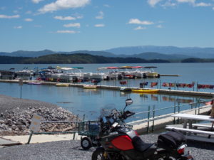
In Dandridge, I head south on Highway 139 along the western shore of the river-turned-reservoir. The road hugs the lakeside and proves a joy to ride. All day I’ve kept watch on the French Broad, noticing the color change from crystal clear with a greenish-brown reflection, to an angry muddy orange, to a blue so deep it upstages the azure skies above. Wanting to admire the immensity of this new version of my little hometown river, I stop at a charming white inn with an adjacent marina.
From the spacious deck of the Mountain Harbor Inn, I look across the lake to the Great Smoky Mountain beyond. The desk clerk invites me to look around. She tells me the bed-and-breakfast, a consistent winner of TripAdvisor’s Certificate of Excellence, caters to honeymooners and couples looking for a romantic mountain getaway, even offering sunset boat cruises along the lake. Inside, elegant tablecloths and flower vases adorn the dining room tables. I notice a stack of place cards awaiting a pending wedding reception. I pocket a brochure at the front desk in case my solitary status ever changes, take a last stroll on the picketed balcony beneath the gabled roof, and turn back toward my 1,000cc companion.
The 201-foot-high Douglas Dam stretches for more than a quarter mile across the French Broad River. The TVA provides a park and scenic overlooks. I ride up to the powerhouse to see the river emerge again, now back to its natural greenish-brown color. I grow both excited and melancholy knowing this is the final section. In less than 20 miles, my river will give up her identity and become just another tributary of the Tennessee, Ohio and Mississippi rivers. Nearing the end of our 200-mile journey, I spot a transportation depot with a barge docked on the shore. The river I’ve known only as a scenic and recreational waterway now serves a new purpose.
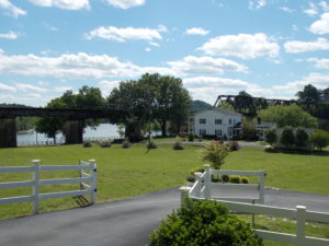
Beneath a towering steel railroad trestle, in the front yard of two-story white farmhouse adorned with Greek columns, the Holston River arrives to merge with the French Broad. I find a shady spot next to the railroad tracks to park the bike gaze down at the birthplace of the Tennessee River. Across the road from the confluence, I spot a cemetery. A marker reads “Lebanon in the Fork Presbyterian Church, 1791,” which makes it older than the state of Tennessee (1796). Headstones dating mostly from the 1800s bear the names of prominent Knox County pioneers and even a couple of Revolutionary War and Civil War veterans.
I sit under a four-columned, standalone portico, built to house the bell from the church that burned in 1981, and reflect on the day’s journey. I find it oddly satisfying that my river ends next to a 200-year-old graveyard. Several hours earlier, I witnessed the French Broad River’s first trickle of life. Looking out into the glint of the afternoon sun on the water, I try to triangulate the exact spot where succumbs to the Tennessee. Its job completed. Walking to the bike, I notice my shadow points the way home, back upstream. Life flows on like a river and next to one as well.
Originally published in the Fall 2017 issue of Blue Ridge Motorcycling Magazine.


