The New River Gorge is bass-ackwards.
Carved by one of the world’s oldest rivers (number two in the world next to the Nile, local folks claim), it hosts the nation’s newest national park. Yet it’s called the “New” River!
The New is an East Coast river that flows north.
But what’s most askew is the nature of the park itself. Consider that most of the national parks, especially the earliest, were pristine landscapes crying for preservation, which the park designation provided. The New River Gorge National Park emanated from a highly industrialized, plundered, raped and ruined landscape. And nature, helped with the designation’s protections, is claiming it back. We tourists are the beneficiaries.
To learn for myself, I headed north from my southwest Virginia home on my untrusty BMW R1200R on a trip through history, ancient and recent, natural and unnatural. I left the four-lane behind just beyond the fissure along the spine of the Virginias at the Narrows, the gap separating Peters Mountain and East River Mountain, what would have been a continuous 90-mile ridge from near Tazewell to near Covington, had the New not cleaved it millions of years ago.
The New River is birthed in the mountains of northwestern North Carolina, flowing northward through the “waist” of Virginia. On its journey, it slices a series of ridges which are common for this part of the state, meaning it was there before they were, carving them as they rose, and these are limestone mountains, among the oldest mountains on earth, once Himalayan in height.
To the north, however, the area now in southern West Virginia is comprised throughout much of the state with sandstone mountains, many of which contain significant deposits of coal. And without coal, the New River Gorge would be a vastly different place.
I entered to West Virginia, at the edge of Peterstown, then headed north to Hinton, the small city at the head of the gorge. It was a cool June morning with no rain in sight. The big BMW strode along lazily, its water-cooled boxer engine providing prodigious gobs-full of torque. I set the electronic suspension for “Sport” to enliven the ride through the continuous curves. If the bike could talk, it would be asserting, “I’m made for this!”
Moments before reaching Hinton, the road put me alongside the Greenbrier River, one of the New’s primary tributaries. The Greenbrier flows southwesterly to reach the New, while on the other side the Bluestone River snakes up northeasterly from the coal country, reaching the New just above the Greenbrier’s confluence.
I drove northward through the town center, where in parts the road splits into two one-way lanes with houses in between with the upper floor on the ground level on the east side and the lower floor at ground level on the west side.
The View at Grandview Point is … well ….
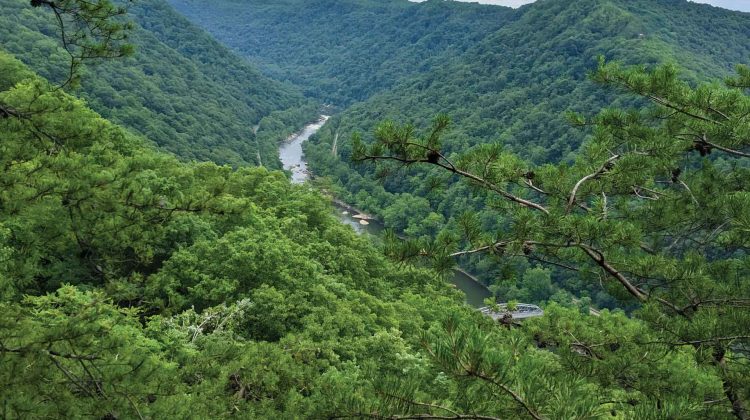
My first stop was Grandview Point at the southern end of the New River Gorge National Park and Preserve. Originally a West Virginia State Park constructed during the Great Depression by the Civilian Conservation Corps, its ownership and custody was taken over by the National Park Service and incorporated into the developing park. Not a particularly inspired name, but definitely true to form, the stone outcropping overlook, a short walk from the parking lot, revealed a spectacular U shaped canyon, the distant New flowing northward from right to left.
The canyon rim was uniform in elevation, roughly 1,000 feet above the peneplain, with the canyon walls clad in deep forest greenery. At the bottom, of course, was the sinuous river. Alongside, paralleling it, was the rail line of CSX, sometimes on both sides. Its peaceful look belied a history of exploitation.
Coal seams are like icing in a layer cake, with the cake being sandstone rock. As the river sliced through this plateau, it exposed four seams of high-quality, smokeless bituminous coal. The smokeless aspect was important in early steam-powered ships as there was no tell-tale smoke trail left behind, visible to the enemy. But indeed this coal fed the boilers of not only ships but trains, factories, and power plants, and coke derived from it fueled the nation’s steel-making furnaces.
So, predictably, with the coming of the original Chesapeake and Ohio Railroad tracks, laid in 1873, the gorge boomed with extractive industrial development. Coal mines, bored into the sides of the gorge, sprung up throughout. A hundred years ago while Yellowstone and Yosemite were still largely pristine wildernesses, the New River Gorge was bustling with commercial activity and a population between 30,000 and 40,000 people. The gorge hosts a number of deteriorating remains of coal mining activities, including tipples, coke ovens, and conveyers, in addition to the ruins of more than 50 company towns.
On the natural side of things, the gorge contains a rich forest with extraordinarily diverse flora, providing essential habitat for at least 63 species of mammals, 48 amphibians, and hundreds of species of birds. Forty different plant communities containing at least 1,342 species and 54 rare plants have been identified in the gorge.
Thurmond is Haunted
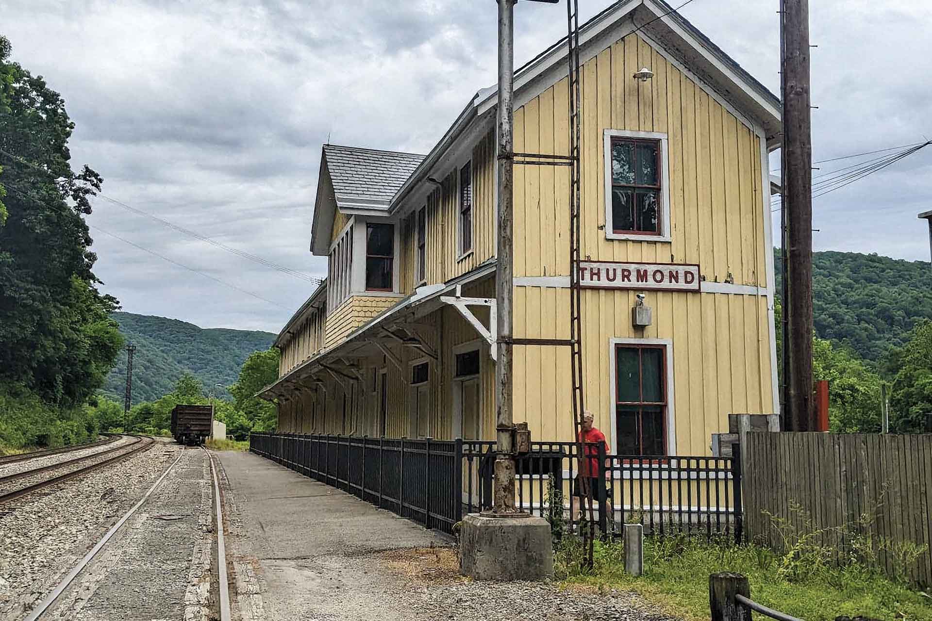
Grandview Point is on a dead-end, so I turned the big BMW around and headed south, then west, then north, then east again into the gorge to the ghost town of Thurmond, arguably the Gorge’s most treasured place.
Incorporated in 1900 and named from the founder, former Confederate soldier William Dabney Thurmond, Thurmond became the Gorge’s most prosperous community. The town’s heyday was in the 1920s to 1940s, hitting a zenith of 462 people in the 1930 census. Five people, four of them women, are reputed to remain today, but nobody seems to know who they are. The post office closed in 1995.
In spite of its near-ghost status, the town still boasts an impressive commercial district of three boarded-up buildings. And an Amtrak stop! If you happen to catch a train, and there are only three per direction each week of the Cardinal, you can go west to Chicago or east to New York. Thurmond is Amtrak’s second-least used station nationally.
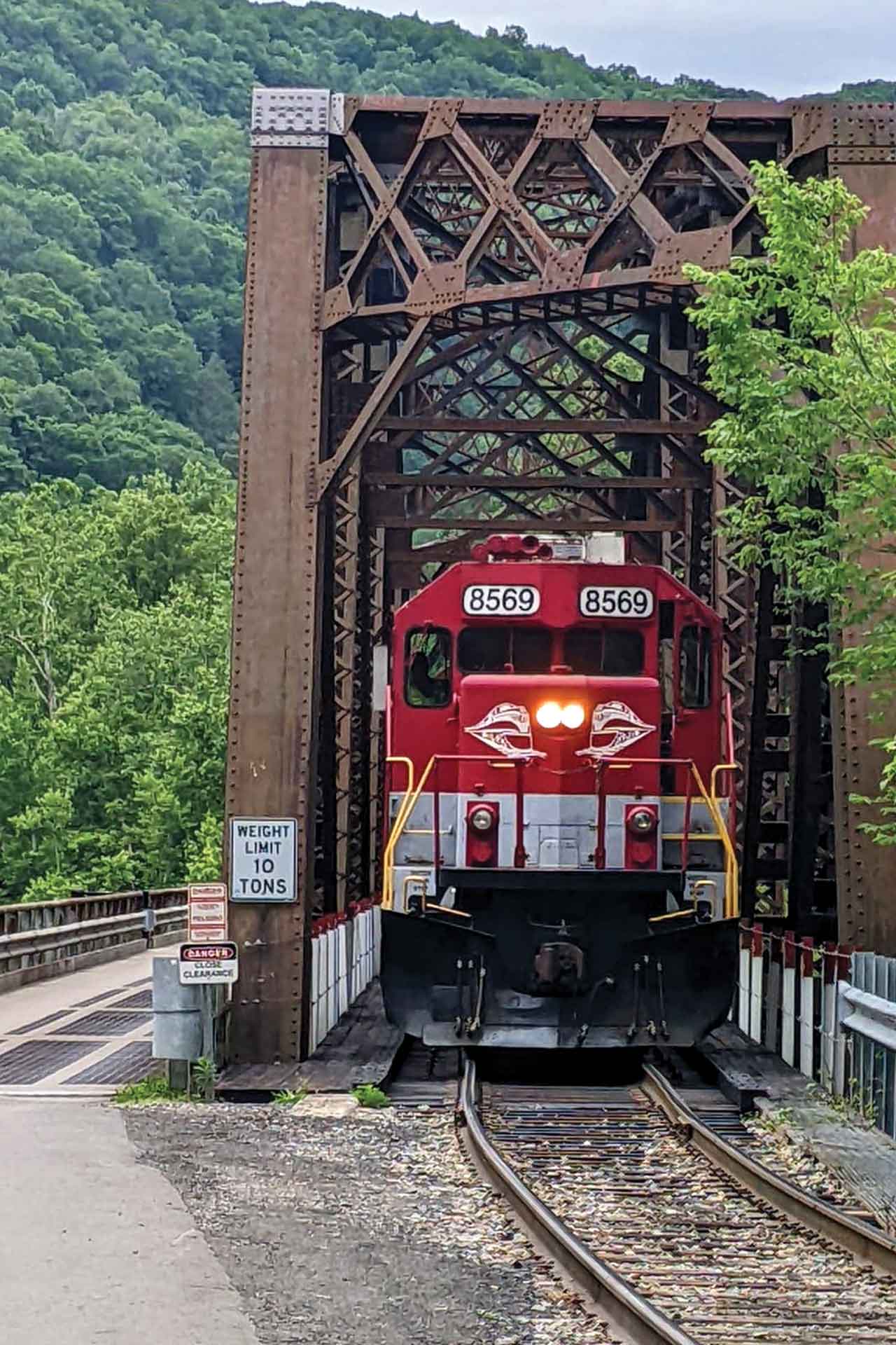
The only road in is appropriately named “Thurmond Road,” West Virginia Route 25, and it gets increasingly narrower as it descends. Near the river, it approaches a branch spur line railroad and piggybacks its bridge over the New on a one-lane, grated bridge deck, which I’d not wish to ride when wet. The long, narrow RR terminal building, built in 1905, abuts the road and tracks, housing the Amtrak waiting room (and it’s a long wait if you miss your train!) and a national park visitor’s center.
Inside, I spoke with seasonal interpretation ranger Matthew Slater. In his fourth season with the NPS, he lives in a park house just up the hill. He told me that the New River Gorge National Park and Reserve is not even two years old. “It has been a National Park unit since 1978, but was then a ‘National River.’ Now it’s a full-fledged park.” He explained that the “Reserve” was open to hunting, still big in the area, and encompassed much of the park. Only the highly visited areas were closed to hunting.
“Last year we had a 30% increase in visitation and we’re up 20% on top of that this year. While in the past, for many visitors this was a stop-over on the way elsewhere, now people are making it a destination, dedicating their trips to come here.
“The park stretches 53 miles along the river from the Sandstone Visitors Center in the south to the Bridge Visitors Center in the north. There is still lots of private land in the park. And there is still coal mining activity.
“For me, there is a rumor about the friendliness in West Virginia,” he continued, our conversation interrupted by the horn of a passing train, “but I’ve not met one unfriendly West Virginian. I’m from Ohio. Even on my days off when I’m not in uniform, I’ve not met anyone who hasn’t been friendly.
“In its boom years, everything and everybody arrived by train. Cars were a death knell for Thurmond. We get many railfans here, just to see and photograph the trains in this setting. With the historic bridge and station and the abandoned business district, it’s a great place to (photograph) trains.”
I wandered outside toward the business district in a row facing the tracks. One once housed the National Bank of Thurmond, where printed on the window was the advertisement “Any Amount Starts an Account,” and boasting “3% Interest in Savings.” Had it been open, I would have left $50 and started my own account. I swear.
I spoke with a fellow motorcyclist whose dressed Kawasaki touring bike sat parked in the shade of a tree, protecting it from the warming sun. Ken Gansel was from Canada, from Niagara On The Lake, Ontario. The bike was a 1600cc Vulcan Nomad, with 115,000 kilometers.
He had all manner of toys with him, from computer devices to cameras to a drone. He told me, “I am the webmaster and road captain of the Southern Cruisers Riding Club for the Niagara region. I’m here chasing trains. This is my third visit.
“I’m also past president of the Canadian Railroad Historical Association. I’ve been photographing, chasing, or riding trains since I was 10 years old and I have 600,000 images, all indexed, most from color slides.”
Gansel was retired from government service, working as an IT manager. He was always interested in computers, photography, and gadgetry.
“I have always enjoyed what I call the windies or the twisties, the local off-the-beaten-track roads. That’s what I come here for, in addition to photographing trains. I’ve done all the roads around here. I’m always looking for photo stops. There were a couple of old barns that said, ‘Mail Pouch Tobacco,’ and those are worth photographs.
“The take-aways here are that the roads are challenging and the scenery is unreal. I want roads that connect me to the environment. Show me old towns. Show me old bank buildings. Show me railroads. That’s what draws me to an area. Almost all my trips have a railroad component. Old stations. Coal facilities…
“I’m a rail-fan, modeler, motorcyclist. Probably put motorcyclist first.”
I spent the next awhile, back at the façade of the bank and the other buildings, intrigued. Thurmond was a rough town in its day, like most resource boom towns. I don’t know for certain if it was haunted, but any of those buildings would have been a great location for any self-respecting goblin: dark, old, with decades of decay. If you peer inside the big picture windows, see if you don’t see a ghost.
So authentic is Thurmond that it was chosen as the movie set for the 1987 John Sayles movie “Matewan,” about the 1920 shootout there. The real Matewan is 100 miles to the west on the smaller Tug Fork River at the Kentucky state line. But Sayles found Thurmond’s unspoiled façades irresistible.
The Bridge
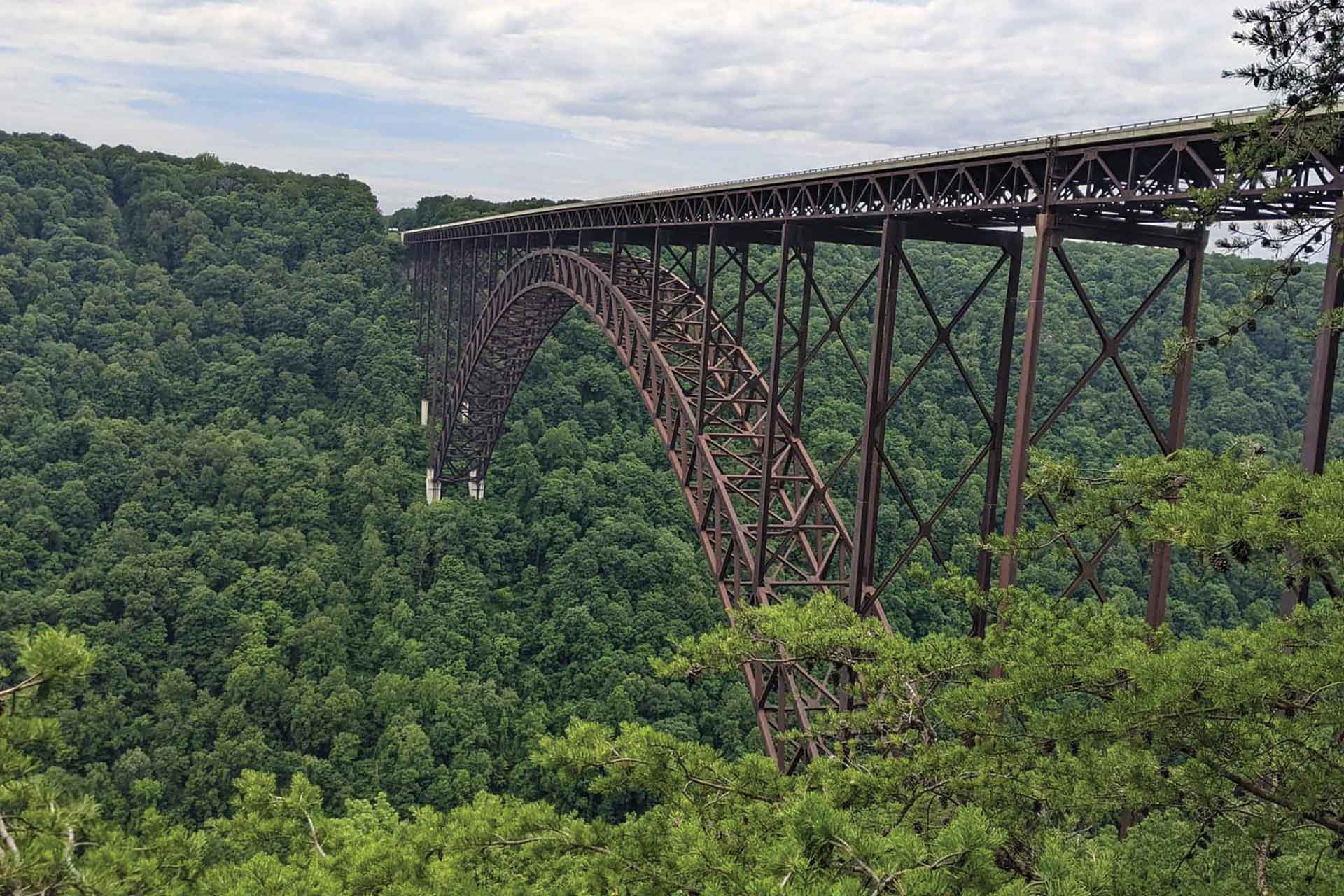
I left Thurmond on the same road and halfway up had to wait 5 minutes for a passing train of empty coal cars, evidently returning to the mine for a new load. I took U.S. 19 northward and over the New River Gorge Bridge, the park’s best known and most impressive feature. A stone’s throw over 3,000 feet long, it spans the gorge from rim to rim, an incredible 876 feet from deck to river. When completed in 1977, it was the longest single-span arch bridge in the world and is now fifth longest, still the longest in the Western Hemisphere. It is widely beloved, with its graceful, spindly look. “Bridge Day” is now an annual October event during which thousands of people walk across and many, presumably using proper equipment, jump from it.
Riding across, you get little sense of its height. But if you do stop on the shoulder and peer overboard, it’s a long way down to the tiny looking rafts bounding above the rapids below. When traffic rumbles by beside you, you can really feel the bridge move, shaking your motorcycle perceptibly. I’m not at liberty to tell you how I know this.
I parked the Beemer at the Visitors Center just north of the bridge and descended 178 steps (count ‘em!), tromping down in my riding boots, on a wooden staircase to a scenic overlook for the compulsory viewing and photo opportunity. I saw more rafts in the river below, where whitewater rafting has become one of the park’s major activities and tourist draws.
The visitors center has the great displays that the NPS is known for, documenting the settlement, industrial history, and natural history of the park, and is not to be missed. Also, be sure to take the old route down the canyon to Fayette Junction below the bridge, with its tight switchbacks on a one-way (westbound) direction.
In addition to rafting, the park offers one of the most popular rock-climbing areas in the country, with over 1,400 designated rock climbs. The fishing and hunting are superb, as is bird watching. There are over 50 miles of hiking and mountain bike trails. And of course train watching. There is much to do in the park.
I spent the night in the “library room” at a lovely B&B in Fayetteville, whose walls were festooned with framed images of long-deceased people who lived before the world was colorized or folks smiled when their photos were taken.
My walking tour of town included the gorgeous red brick circa 1895 courthouse, the county seat of Fayette County, named for Marquis de la Fayette, the Frenchman who assisted the Continental Army during the Revolutionary war, and the town hall, above whose entrance is a sign saying, “One of America’s Coolest Small Towns,” presumably not for the prevailing climate.
The next morning, I fired up the BMW for a 15-minute ride to Glen Jean, the park headquarters, to meet with David Fuerst, and Leah Perkowski-Sisk. Fuerst is a cultural resource program manager and Perkowski-Sisk is a supervisory park ranger and public information officer for the National Park.
We met in the historic Bank of Glen Jean building, which operated from 1909 until 1939. With its 28-inch thick exterior walls of local stone, it is now on the National Register of Historic Places.
Perkowski-Sisk said, “I work primarily out of the Sandstone and Canyon Rim Visitors Centers. Our staff interact with the public, answering questions, and doing education and programs. Hikes. Tours. Environmental education. Social media for the park. We also go to schools for outreach education.”
She reiterated that it had been part of the National Park System since 1978, but changed in 2020 from a National River to a National Park and Reserve.
Fuerst said, “I help manage cultural resources. Our mission is to protect cultural resources, things like historic buildings and industrial structures. This building in Glen Jean reflects the coal mining era, how we interpret the park. It was built in 1909 on a spur RR line to the main line down the canyon in Thurmond. The main line was completed in 1873, and it was like the coming of the Lord. It changed the whole landscape in a profound historical way. Prior to that, there was no transportation link east to Virginia or up to the Midwest states. It opened the area to development. Thurmond was an important part of that. It had a railroad yard and switching station. It became the highest revenue acquisition area along the whole C&O line.
“The founder of the town recognized the strategic location. After spur lines came up from the canyon, this area of Mt. Hope, Fayetteville, Beaver, Oak Hill, and Beckley, all flourished. There are still lots of coal mining operations in the area. Much of this area is underlain by played-out (depleted) mines.”
Perkowski-Sisk grew up in nearby Beckley and said that her entire NPS career was in this Park. “This new designation has meant lots more notoriety, not just southern West Virginia but West Virginia as a whole. We are one of 63 national parks. We have visitors that try to visit all of them. We have awareness we’ve not previously had. And it has created more local interest. This has always been in their back yard, but they’re coming in to see what the hoopla is about.”
Fuerst continued, “There are many stories here. There are many private inholdings of farming and agriculture. Our story includes coal mining, farming, railroads, banking, lumbering, rafting and kayaking, railroad watching, bird watching, fishing, camping, hiking, and bicycling. We are internationally recognized for rafting and rock climbing. We have at least 500 archeological sites in the park. We have over a million and a half visitors a year. The New River basin is part of the largest contiguous deciduous forest in the world stretching all the way to Georgia. It was a denuded landscape, but it has recovered. Our habitat has recovered, too.”
There are four primary areas of interest in the park, each with its own visitor center: Canyon Rim, Thurmond, Grandview, and Sandstone.
Perkowski-Sisk said, “It’s a unique and special place. There’s great recreation. The natural environment has global significance. Some parks are historically based. Some are wilderness or scenery based. This park is a total package.”
Fuerst agreed, saying, “This is a treasure waiting for you to discover.”
Perkowski-Sisk quipped, “If you get bored here, it’s your own fault.”
Not wanting to return on the same route I took from home, I descended the Gorge on SR-41 to the river village of Prince, population 116, and back up the east side. My route home involved a dozen miles on a scary “lay-over” road, paved in the center with gravel shoulders where oncoming cars have to lay-over their outside wheels on the gravel to have room to pass, to the outskirts of Alderson, a lovely Greenbrier River town upstream of the confluence with the New.
The Hinton, Talcott, Alderson, Ronceverte, and Lewisburg corridor has much to explore, too. I’ll be back.


