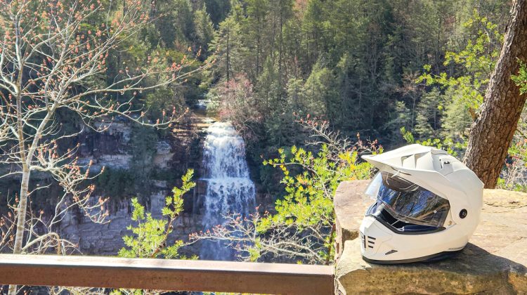
My first roadside break of the morning began at Washington Ferry on the western bank of the Tennessee River. Happy to be on another road trip, I savored the quiet riverfront view, although I fear the lone fisherman initially hidden from my view was probably annoyed by my approach on the raspy three-cylinder Yamaha sport-touring bike.
The fisherman packed up and departed without a hello.
It’s early spring, and this scenic back road I first spied on Google Maps does not disappoint. I plan to ride Tennessee Highway 30 to a few scenic waterfalls hidden in the Cumberland Plateau. I often enjoy plotting a great motorcycle road trip as much as taking actual journey. In the morning air, I stood by the squiggly blue line I’ve studying on my map for months — the mighty Tennessee River. Today felt like the dawn of a new motorcycling traveling season.
A rhythmic clunk drew my attention to the bridge above where Highway 30 crosses the wide-and-tranquil river. The ubiquitous concrete-and-steel bridge did its efficient job getting a truck across the expanse, but at this moment, an old-time ferry across the river would be more interesting for me.
Thinking this was frontier-era historic site, the modern reflective road sign proclaiming “No Night Ferry” seemed puzzling. A nearby historic marker informed me this ferry spot about 7 miles west of Decatur, Tennessee, had nothing to do with George Washington except for being named for a community nearby. It first opened in 1807 and continued operating until 1994, one of only five such ferries to survive into the 20th century.
Finished with my pebble-kicking, I sped westward toward the dark blue line above the horizon: The Cumberland Plateau.
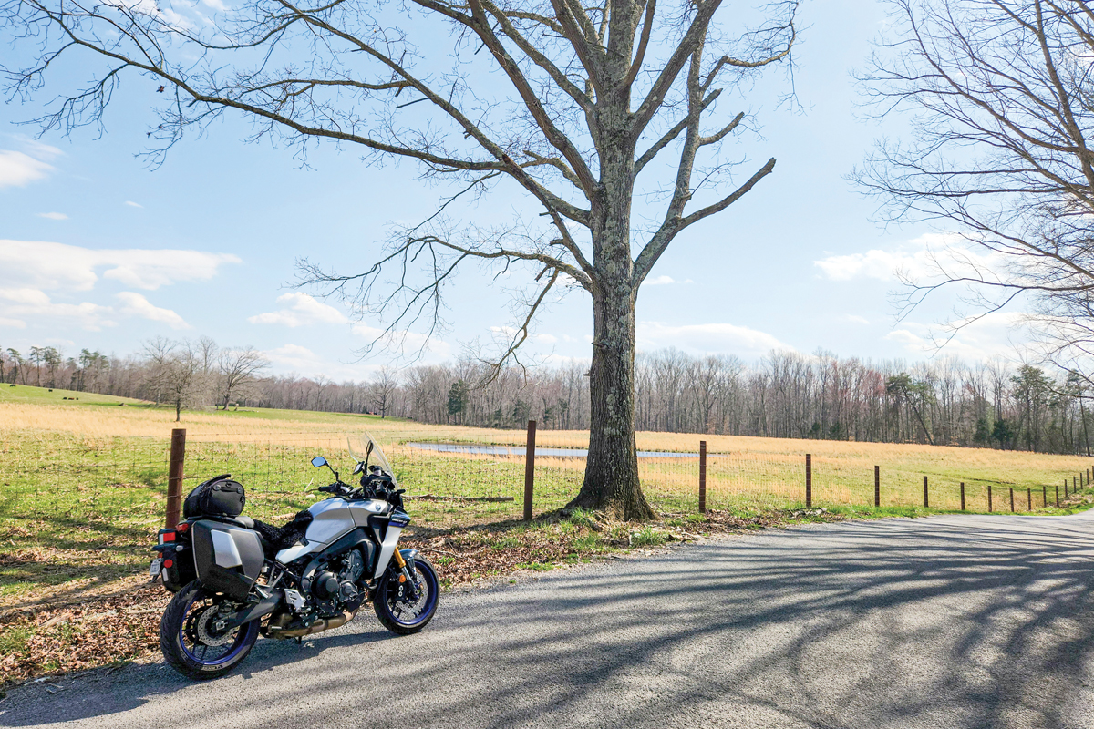
The Cumberland Plateau is a flattish geological uprising that extends from northern Georgia and Alabama through Tennessee into Kentucky and Virginia. It’s similarly named neighbor, the Cumberland Mountains, borders the Blue Ridge Mountains and runs from Tennessee to West Virginia.
Last year, I followed the Tennessee River from Tennessee into Alabama, exploring the Cumberland Plateau near Chattanooga. I knew there was much more to see, so this this time I made an expedition into the heart of this natural wonder.
A few miles past the town of Dayton I spotted a newly built convenience store and restaurant on the side of Highway 30, Xander’s Store and Restaurant. I could use another boost of caffeine, so I slow-rolled into the newly graveled lot.
I always ask the locals if there are any nice scenic roads or twisty turns in the area. Heydhy Ramos at Xander’s store assured me I was in for some of those if I kept going.
“You’ll enjoy the one going down toward Pikeville, down the mountain, which is this one (Route 30), and going toward the falls is nice,” she said.
I’d discover the sharp twists ahead were transecting Walden’s Ridge and taking me into the scenic Sequatchie Valley and closer to my first real destination of the day: Fall Creek Falls State Park.
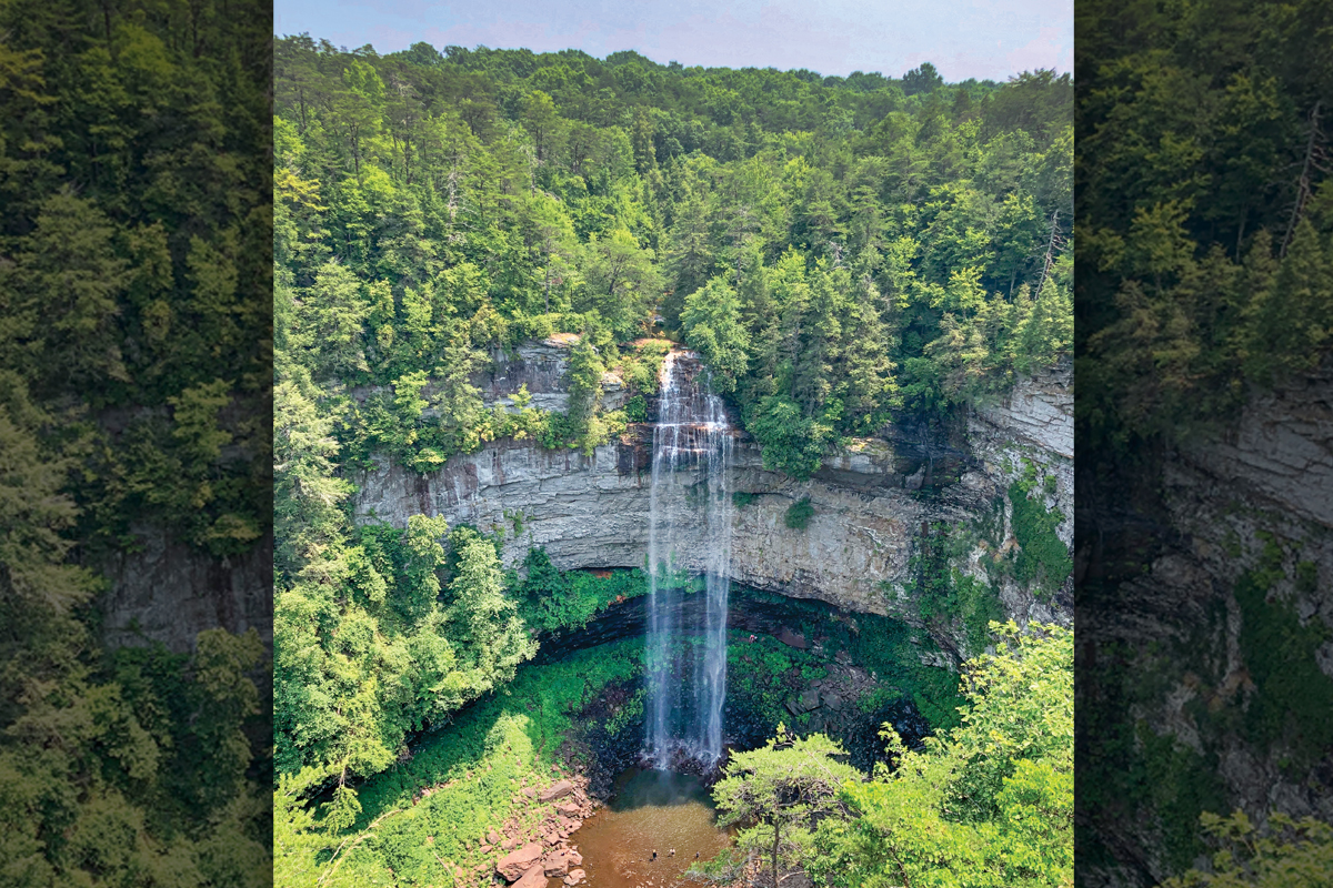
“I’m originally from Florida. When I came here, my first stop was Fall Creek Falls, and I loved it,” Ramos said. “I love the Rock View, I think it’s called, where you can see both views. You can go down from the main Fall Creek Falls and to the other part. You can see such a beautiful view. Both waterfalls are beautiful.”
With my tailbag filled with more sodas and snacks, I nudged my Yamaha Tracer 9 GT onward. Highway 30 continued to impress me with satisfying sweepers and a few technical switchbacks. I soon emerged in a narrow valley filled with the town of Pikeville.
“One of the most beautiful parts of the plateau area is the Sequatchie Valley where Pikeville is. It’s like a little slice of the plateau is carved out into this long, straight valley with escarpments on each side,” Sarah Leedy, a park manager and ranger at Fall Creek Falls State Park, would tell me later. “Occasionally there is a couple of places where a highway will actually climb that escarpment and get up on the Cumberland Plateau or Walden’s Ridge on the east. It makes for a lot of switchbacks and fun motorcycling riding.”
Fall Creek Falls, about 25 miles west of Pineville, has intrigued me for years, ever since I first saw someone post a photo of it on social media. Waterfalls are nothing novel to this native of the Blue Ridge Mountains, but this cascade is nothing like most of the waterfalls I’ve seen.
“The big draw in Fall Creek Falls State Park is its namesake, a 256-foot-tall waterfall. It’s one of the highest waterfalls east of the Rocky Mountains. It’s distinctive in the fact that it is a free drop from that height to a plunge pool below. That makes for a really dramatic setting. It’s breathtakingly beautiful,” the park manager said.
A short, level walkway from the parking lot gives visitors easy access to the stunning vista. The park features a nice loop road with several other overlooks and hiking trails for visitors to enjoy. Access is free and the park features a wealth of outdoor fun for vacationers.
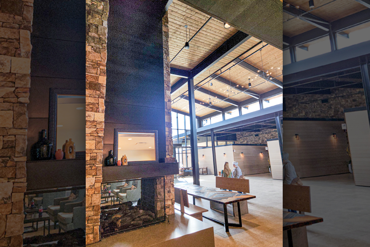
“The park is also a resort park, so we have a variety of amenities,” Leedy said. “It’s a build-your-own adventure kind of place. We’ve got everything from backcountry camp sites up to traditional campgrounds, RV campgrounds, cabins, group facilities all the way up to our new lodge.”
The park completely rebuilt the lodge a few years ago. It sits on a scenic mountain lake with a full-service restaurant, conference center, gift shop, paved parking lot and 85 guest rooms. Paddleboards and kayaks can be rented ad the park also features an 18-hole golf course.
“One of the great things about coming to visit Fall Creek Falls is it’s a little bit off the beaten track. You don’t accidently get to Fall Creek Falls. It makes a really good basecamp,” Leedy said. “If you’re chasing waterfalls along the Cumberland Plateau, we’re a great place to stay. Rock Island is about 30 minutes away, Burgess Falls is about 45 minutes away, Cummings Falls is about an hour away. You can go south and hit Savage Gulf and South Cumberland State Park in about an hour.”
Leedy said the park, campground and lodge draw a lot of groups each summer, including wedding parties and corporate retreats. It’s also a favorite of motorcycle touring groups and sports car clubs.
“If you like curvy touring, you’ve got a lot of that around here,” the park manager said. “It’s a nice two-lane scenic drive. Highway 30 is one of those, lots of switchbacks in a short amount of time. Not just from Pikeville to Fall Creek Falls but on to Spencer and McMinnville.”
True to her descriptions, the road to Spencer was just as enjoyable as my crossing from Pikeville, rolling hills, little traffic and picturesque countryside.
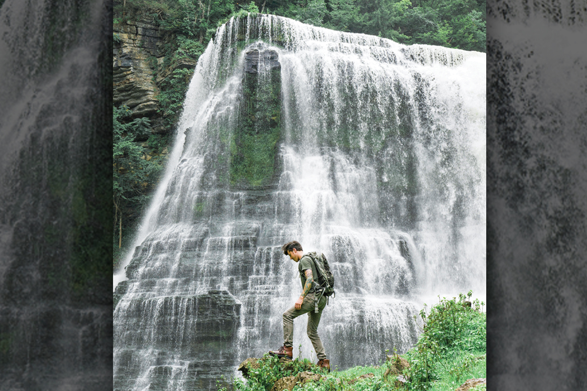
In Spencer, I headed north toward my next waterfall hunt, Burgess Falls State Park. Again, I’ve been mesmerized by photos of the falls, but was disappointed to learn there is no access to the base of the falls. Just reaching them requires a 3-mile round trip hike to view them.
The Falling Water River creates four waterfalls that cascade down the plateau. The largest, Burgess Falls, plunges 130 feet. A dam on the river helped generate hydroelectric power for the city of Cookeville until the end of World War II. Remnants still remain in the park from its industrial past.
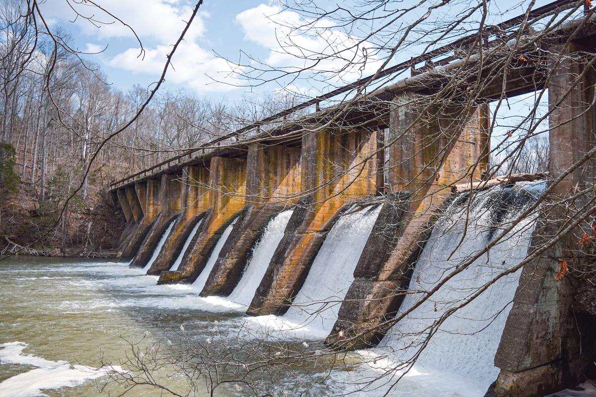
Clad in motorcycle pants and boots, I skipped the strenuous hike since the best view was closed anyway and just enjoyed the spillway and small waterfalls close to the paved parking lot. Crowds filled the park on this lovely day, and my solitary nature kept urging me to just jump back on the bike and head to the next one. Clicking up into second gear while leaving the parking lot immediately improved my mood.
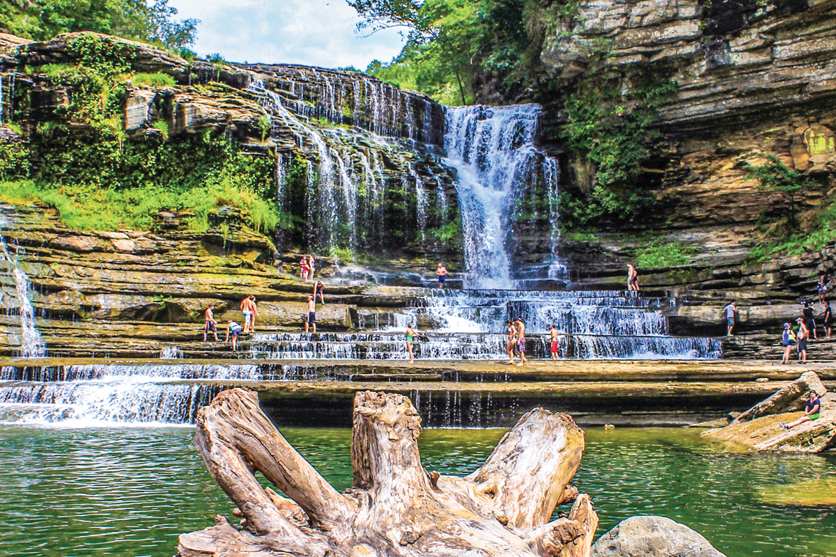
About a half-hours ride through some lovely backroads delivered me to Cummings Falls State Park northwest of Cookeville. Tennessee’s state parks in this region all seem well-maintained with convenient restrooms, spacious parking lots and helpful staff. As I parked the bike, I noticed a horse adorned in high-viz reflective accessories tethered out front. Rangers use the steed for patrols and rescues.
Access to the gorge usually requires a permit and is often closed, so check the Tennessee state parks website for updates.
I took the undulating, unimproved trail about a quarter mile to the falls. A nice overlook with handrails extends you from the riverbank so you can enjoy the view of the cascading waters. The stratified rocks surrounding and Cumming Falls — and Burgess Falls as well — create a peaceful stair-step structure as the water tumbles from terrace to terrace.
As I leaned against the railing, I consciously tuned by senses to take in rushing water, the sunlight streaking through the newly budding trees, the detailed layers of the sedimentary rockface opposite me. Like most riders, motorcycle travel gives me a connection to the world and a zen-like view of being present in the moment and in the place. After a while, a group of park visitors arrived at the overlook, breaking the dreamlike spell of being alone in the wilderness next to a beautiful waterfall.
Having accomplished my goal of visiting these Cumberland cascades, I pondered my route back to Western North Carolina. Interstate 40 would be the obvious choice for speed and efficiency. Looking at the map, I noticed a quick detour north of I-40 would give me the chance to make another visit to the Devil’s Triangle, a wonderful motorcycling route through the Cumberland Mountains.
The Devil’s Triangle makes a 44-mile loop connecting state routes 62, 116 and 330. Route 116 makes up two sides of the triangle and takes you past the former Brushy Mountain State Penitentiary, which now hosts a distillery and restaurant. Riders will find steep, technical section and miles of flowing curves. You can catch sight of mountaintop windmills, small roadside waterfalls and rarely any traffic. There are no stops for fuel, lodging or amenities, which makes this tourist-sounding road all-the-more appealing for riders who simply want the essentials: a swift motorcycle and an open road.
A meandering mix of byways eventually lead me to Knoxville, where the Holston and French Broad rivers form the mighty Tennessee River. For me, the waterway always serves as the border marking my passing from the Cumberland Mountains and Plateau into the Great Smokies and Blue Ridge mountains.
Those long, flat-topped ridges disappear in my mirror as the pointed, cone-shaped summits roll toward me. With some guilt, I tell myself I prefer the Blue Ridge’s softer slopes to the Cumberland’s angular aspects. Yet I know I’ll be back exploring the plateau again. I was too lazy to make the hike down to Burgess Falls, so I have an excuse to return. Next time, I’ll pack more comfortable shoes.


